Pleszew County
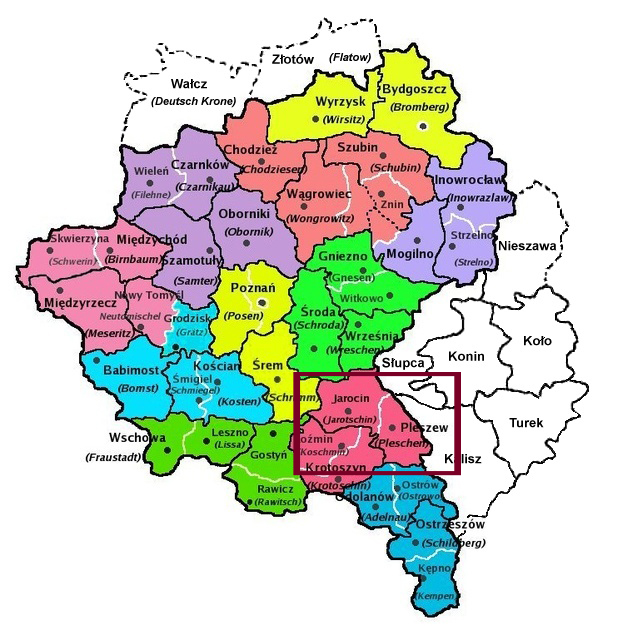
The following administrative information was taken from the entry for Pleszew in the Słownik geograficzny Królestwa Polskiego i innych krajów słowiańskich . The information was written between 1880-1914. Also, information was taken from Meyers Gazetteer. In 1887, German administrative reforms took place and the number of districts went from 26 to 42. This change lasted until the end of World War I. The information below reflects the pre-1887 administrative districts. The districts of Pleszew and Jarocin are combined.
District (Regierungsbezirk):
Poznań (Posen)
Catholic Parishes:
Broniszewice, Brzezie, Cerekwica, Czermin, Dębno, Droszew, Golina, Gołuchów, Góra, Górzno, Grodzisko, Jarocin, Jedlec, Karmin, Kolniczki, Kotlin, Kowalew, Kretków, Kucharki, Kuchary, Kuczkó, Lenartowice, Lutynia, Magnuszewice, Mieszków, Nosków, Nowe Miasto, Panienka, Potarzyca, Radlin, Raszkó, Rusko, Siedlemin, Słaoszew, Sobótka, Solec, Sośnica, Sowina, Tursko, Twardów, Wilkowyja, Witaszyce, Zegocin, Zerków
Courts:
District Court (Landgericht):
Ostrowo
Lower District Court (Amtsgericht):
Jarocin, Pleszew
District Military Command (Bezirkskommando):
Śrem (Schrimm)
Civil Registries:
Góra, Jarocin, Kamień, Kotlin, Kretków, Mieszków, Nowa Miasto, Rusko, Tarce, Żerków, Żółków, Czarnuszka, Czermin, Kucharki, Kuczków, Pleszew, Rokutów, Sobótka
The German Provinces and Districts required Civil Registrations for Birth, Marriage, and Death records. These events were recorded at the various Civil Registries within the Province. These Registers can be found on multiple websites that provide access to these records.
Province of Posen
Kreis Pleschen
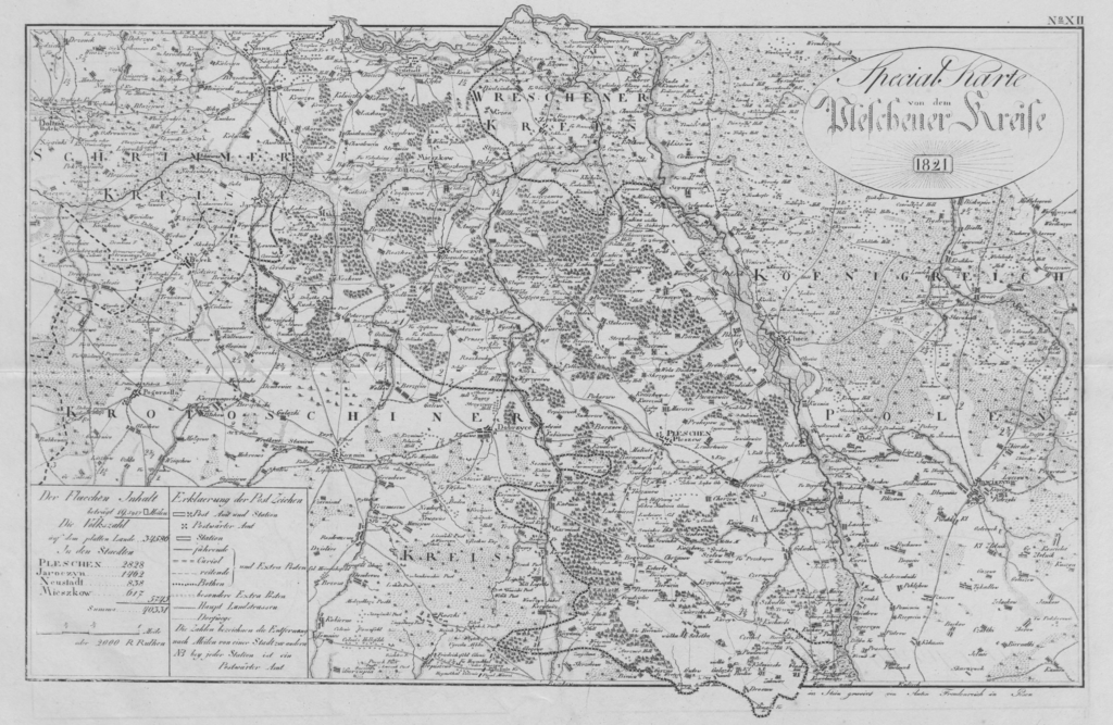
 Source: Anton Freudenreich – General-Karte von dem Regierungs-Departement Posen im Grossherzogthum Posen entworf. u. gez. von E. Peschell. Auf den Stein gez. u. grav. von Anton Freudenreich. Image taken from: https://de.wikipedia.org/wiki/Kreis_Pleschen?oldformat=true#/media/Datei:Kreis_Pleschen_1821.png
Kreis Pleschen
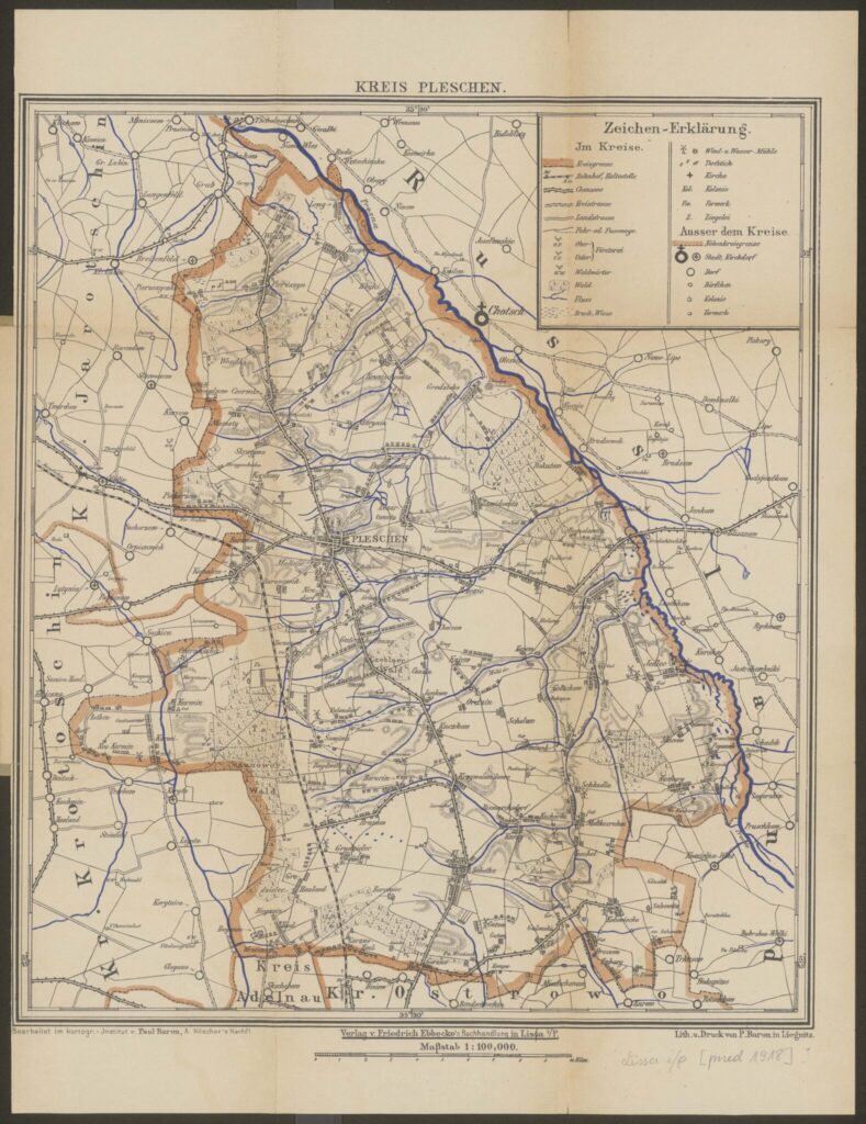
 Spezial-Karte des Kreises Pleschen : Maßstab 1:100 000 Kreis Pleschen Baron, Paul. Druk Geographisches Institut Paul Baron (Legnica) Opracowanie Friedrich Ebbecke’s Verlag. Wydawca [przed 1903] 1903-01-01 ger pl Lissa i/P. : Verlag v. Friedrich Ebbecke’s Buchhandlung, [przed 1903] (In Liegnitz : Lith. u. Druck von P. Baron). Topografia DBN Podział administracyjny DBN Pleszew (woj. wielkopolskie ; okolice)
Pages
- Forum
- Home Page
- Blog Posts Page
- About Me
- Slownik Geograficzny Translations
- Vistula Land – Russian Empire
- Nieszawa County – Warszawa Gubernia, Vistula Land, Russian Empire
- Włocławek County – Warszawa Gubernia, Vistula Land, Russian Empire
- Lipno County – Warszawa Gubernia, Vistula Land, Russian Empire
- Koło County – Kalisz Gubernia, Vistula Land, Russian Empire
- Słupca County – Kalisz Gubernia, Vistula Land, Russian Empire
- Koniń County – Kalisz Gubernia, Vistula Land, Russian Empire
- Turek County – Kalisz Gubernia, Vistula Land, Russian Empire
- Kalisz County – Kalisz Gubernia, Vistula Land, Russian Empire
- Ostrołęka County – Łomża Gubernia, Vistula Land, Russian Empire
- Maków County – Łomża Gubernia, Vistula Land, Russian Empire
- Province of Posen, German Empire
- Strzelno County – Posen, German Empire
- Inowrocław County – Posen, German Empire
- Mogilno County – Posen, German Empire
- Wyrzysk County – Posen, German Empire
- Chodzież County – Posen, German Empire
- Wągrowiec County – Posen, German Empire
- Szubin County – Posen, German Empire
- Żnin County – Posen, German Empire
- Września County – Posen, German Empire
- Pleszew County – Posen, German Empire
- Province of West Prussia, German Empire
- Kociewe Region Research
- Links
- Disclaimer
Categories
Blog Post Calendar
| M | T | W | T | F | S | S |
|---|---|---|---|---|---|---|
| 1 | 2 | 3 | ||||
| 4 | 5 | 6 | 7 | 8 | 9 | 10 |
| 11 | 12 | 13 | 14 | 15 | 16 | 17 |
| 18 | 19 | 20 | 21 | 22 | 23 | 24 |
| 25 | 26 | 27 | 28 | 29 | 30 | |


